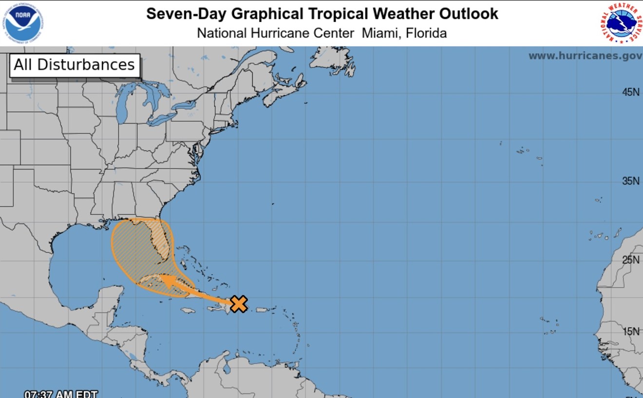

On Friday morning, the National Hurricane Center in Miami said Invest 97L, "a well-defined tropical wave," is expected to strengthen over the Straits of Florida tonight or tomorrow and could bring downpours to South Florida.
As of Friday at 2:30 p.m., a tropical storm warning was in effect for South Florida's southern Gulf Coast. A tropical storm watch was in place in the Florida Keys and Central Gulf Coast areas stretching from Bonita Beach to Aripeka.
The disturbance has generated showers and thunderstorms over eastern Cuba, Hispaniola, the southeastern Bahamas, and Jamaica.

The forecast track for the tropical wave predicts landfall on Florida's Gulf Coast or the Panhandle.
National Oceanic and Atmospheric Administration graphic
The National Hurricane Center forecast indicates potential further development into a tropical storm. Early models show a wide stretch of west and northwest Florida have a significant chance of tropical-storm force winds, stretching from the Big Bend region down to Lee County. Rainfall could exceed eight inches in the hardest-hit areas.
As of Friday afternoon, a flood watch was in effect for all of southern Florida through Sunday evening. The National Weather Service of Miami said residents should "expect 4 to 8 inches with isolated totals up to around 12 inches." The chances of tropical-storm force winds in Miami-Dade and Broward counties are low, between five and ten percent, according to National Hurricane Center models.A Flood Watch is in effect for all of South Florida, effective now through Sunday evening. Deep tropical moisture associated with PTC 4 will allow for high rainfall rates with showers and storms that develop. Expect 4 to 8 inches with isolated totals up to around 12 inches. pic.twitter.com/AMEz7mc7fX
— NWS Miami (@NWSMiami) August 2, 2024
A NOAA Hurricane Hunter aircraft is set to investigate the system today.
If the wave does develop, it would be named Debby.
Gov. Ron DeSantis declared a state of emergency for most Florida counties on Thursday as the Florida Panhandle and state's Gulf Coast remain in the storm's cone of uncertainty. Meteorologist Brian McNoldy told New Times on Thursday the disturbance will likely intensify once it passes South Florida.

Satellite imagery on August 2, 2024, shows a tropical wave over Cuba.
National Atmospheric and Oceanic Administration satellite photo