Around 4:30 a.m. Tuesday, Ian touched down on Cuba's Pinar del Rio province, where forecasters warned of life-threatening storm surge up to 14 feet, flash flooding and mudslides, according to the National Hurricane Center (NHC). In the province, officials had reportedly set up 55 shelters, evacuated 50,000 people, and taken measures to protect tobacco crops that fuel the region's economy.
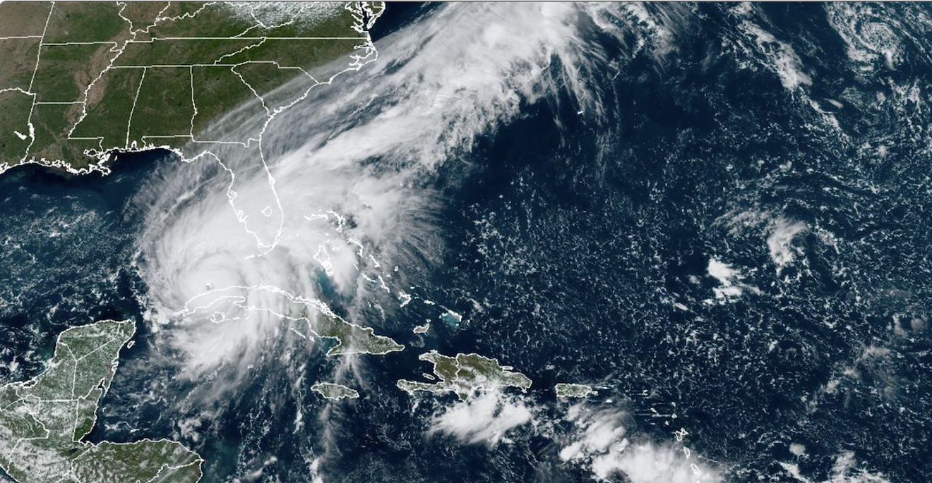
Ian is now on its way toward the southeastern Gulf of Mexico, where it is expected to strengthen before making landfall as a Category 3 hurricane in Florida, between Lee County and Levy County Wednesday night into early Thursday morning. If the hurricane makes landfall in the Tampa Bay area, which is near the center of the forecast cone, it would potentially mark the bay's worst direct hit from a major hurricane since 1921.
“This is going to be a storm like we have not seen in the past,” Tampa Mayor Jane Castor said during a news conference Monday, calling Hurricane Ian an “incredible storm.”
More than 2 million Floridians are currently under some type of evacuation order, Governor Ron DeSantis said during a Tuesday morning news conference in Tallahassee.Here are the 11 AM EDT Sep 27 Key Messages for Hurricane #Ian. Residents in the Hurricane and Storm Surge Warning areas should rush all preparations to completion and follow the advice and evacuation orders of local officials. More: https://t.co/tW4KeGdBFb pic.twitter.com/iT2nCxb4O3
— National Hurricane Center (@NHC_Atlantic) September 27, 2022
The storm's impact is expected to be felt across the Sunshine State, with bands of heavy rain and tropical-storm-level winds stretching from the Florida Keys to the Panhandle. On Tuesday afternoon, winds and rain appeared to be picking up in Key West, with some streets already flooding and waves toppling the sea wall behind the landmark white-striped buoy at the Southernmost Point.
The area could see a peak storm surge of between 2 and 4 feet and wind gusts of between 60 and 70 mph this evening. Key West officials have opened a shelter for people who reside on boats and mobile homes.
Although southeastern Florida remain outside of the forecast cone for a direct hit, flooding has already impacted much of the region, with rainfall totals already exceeding three inches in parts of Miami-Dade and Broward. Storm drains were overflowing as cars inched through waterlogged streets of flood-prone Brickell. Several more inches of rain are expected this evening in some areas of South Florida.
Meanwhile, hundreds of thousands of residents on the state's west coast began evacuating from vulnerable coastal communities on September 26. Counties spanning almost the entire west coast of Florida have mandatory evacuation orders in place, including Hillsborough, Pinellas, Citrus, Lee, Charlotte, Sarasota, Manatee and Pasco counties.
Pinellas County Sheriff Bob Gualtieri minced no words with his directive.
“For all practical purposes, get out right now," Gualtieri warned residents.
Tampa, Florida’s third-most populous city, is gradually shuttering ahead of Ian’s arrival. The international airport reportedly plans to close Tuesday at 5 p.m., and several school districts in the area will be closed this week. Aerial footage from Florida Department of Transportation showed a stream of cars clogging up the I-4 highway leaving Tampa Bay area around 10 p.m. on September 26.
Tampa Bay has been forecast to see between 5 to 10 feet of storm surge. St. Petersburg and Tampa are expected to receive more than 15 inches of rainfall from Hurricane Ian.
“When I look at this storm I feel like I felt when Andrew was approaching Miami and when Katrina was approaching New Orleans,” Jeff Masters, a meteorologist for Yale Climate Connections, told the Tampa Bay Times. “We have a potential historic catastrophe in the making.”
A number of experts, as well as DeSantis, have compared Ian's path to that of Hurricane Charley in 2004. An unexpectedly powerful hurricane, Charley quickly developed into a Category 4 storm and shifted from its forecast track before striking Cayo Costa, an island off Florida's Gulf Coast. The storm killed at least nine people and caused an estimated $6.8 billion in damages.